Free Comic Book Day!

Dear Liza,

Saturday was National Free Comic Book Day, and we walked out into the Portland rain to celebrate.

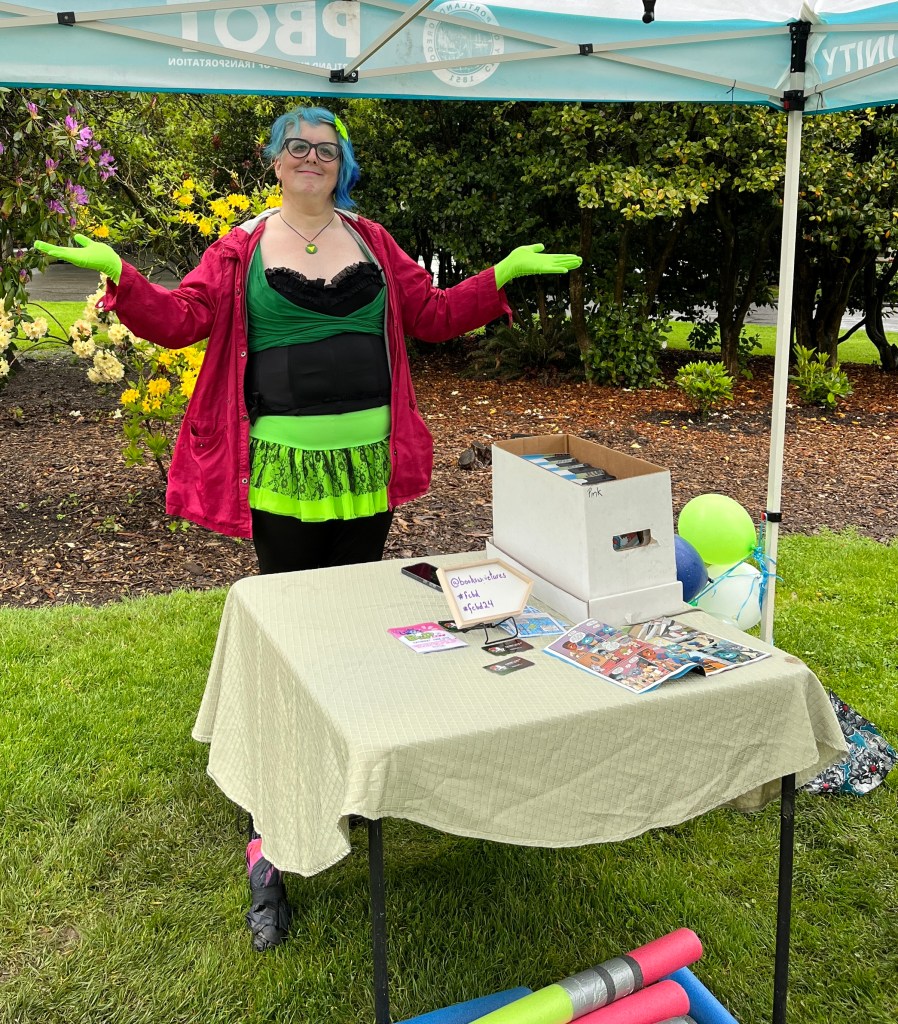
At the Ladd’s Circle Park, we found Siri hosting some pool noodle Light Saber contests and handing out “Young Jedi” comics. As you can see, the rain did not dampen their spirits.

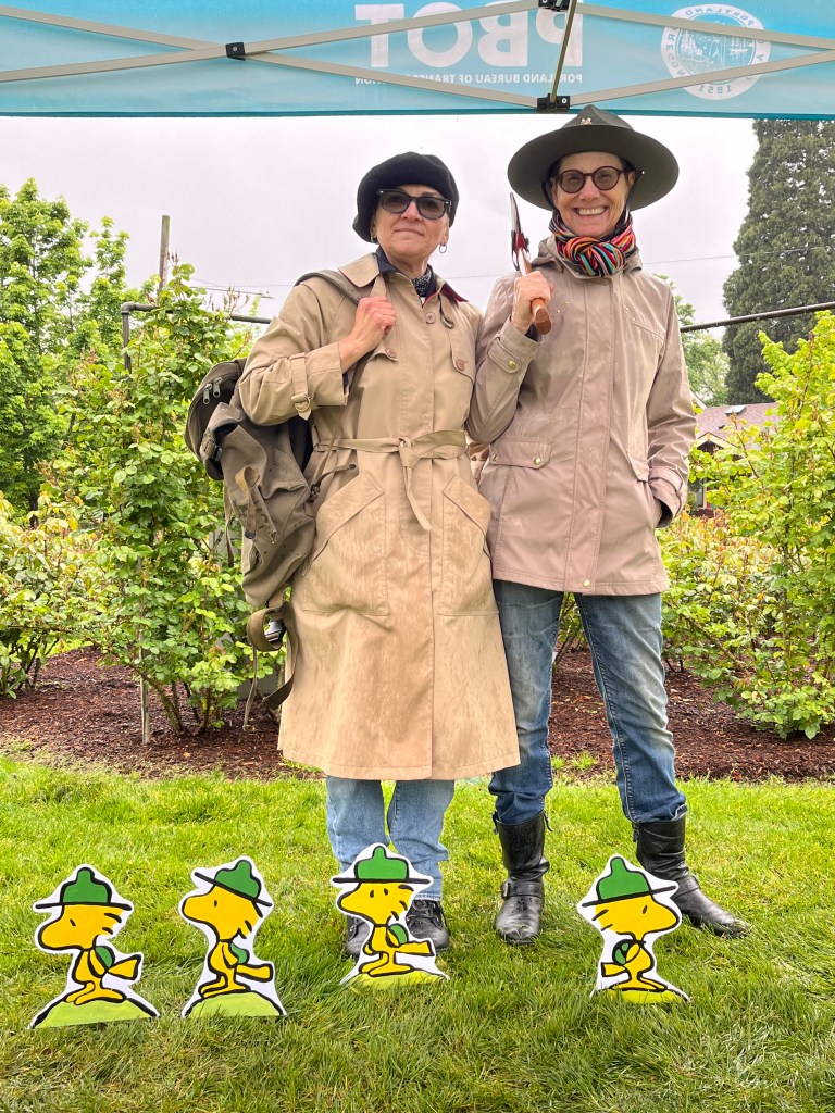
Further into Ladd’s, we found Cecily hosting photo ops with this troop of Charles Schulz’s Beagle Scouts and handing out Beagle Scout comics.Why are these little guys so cute? Because Auntie Bridgett painted them, that’s why!

We were getting pretty wet, but wanted to stop by and see Katie at her shop, Books with Pictures. After all, all these tents and activities had been masterminded by Katie and her wonderful staff as a way of building community with fun activities around comics.

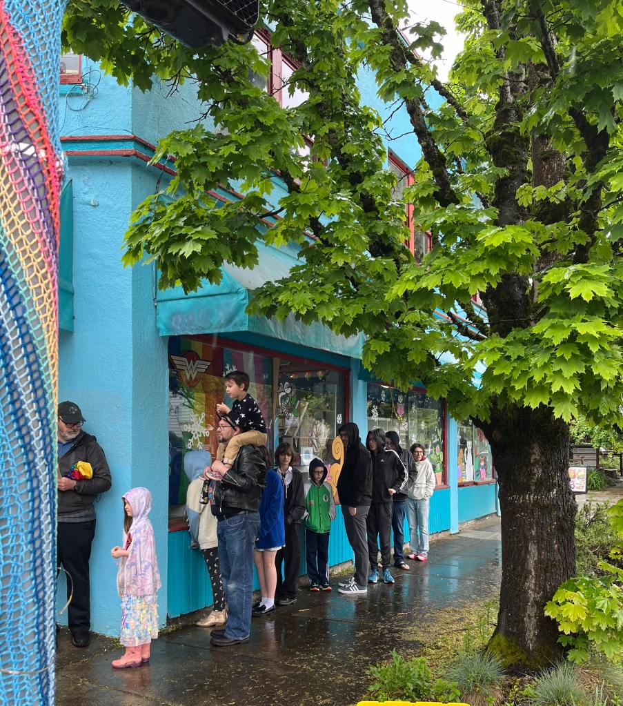
We discovered that the shop was full to bursting, with a line out the door! That’s a lot of good vibes there, with folks chatting and staying dry. Sadly, there was so much going on, we didn’t get to hug Katie. A quick wave and a blown kiss will hold me until we see her.

Just up the street we found Charlie on the Abernethy playground, helping people hunt up Pokémon and giving out comics. This little fellow helped me find one!

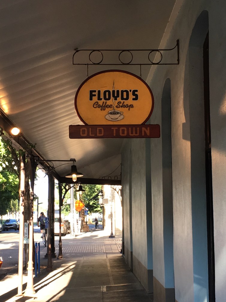
The rain got heavier and we finally had to call it quits. We sloshed up to Floyd’s Coffee House on Ladd’s Circle for a hot beverage and a sweet treat.

Another volunteer for Free Comic Book Day was there! Felix had us draw pictures of things that frightened us and gave us a scary comic. It’s not my style, but I can put it in one of our Teeny Tiny Libraries.

When we were warm and fed, we waved goodbye to Felix and headed up to catch the number 14 home.

What a perfectly Portland day.

Love,

Grandma Judy

Weird Geography

Dear Liza,

IMG_9140.jpg
Floyd’s Coffee

Last night we went to a really old part of Portland. The buildings here were built in 1888, 1900, 1906… these are old! These buildings are beautiful, built of brick with either cast iron or glazed ceramic tile decorations. They were originally used as offices, warehouses or apartment buildings.

This part of town used to be busy and prosperous, but now it is more run down. Like many neighborhoods that have fallen into disrepair, it is looking toward a rebirth. There are some restaurants and offices being installed in these lovely old buildings.

img_9132.jpg
The 1888 Blagen Block, now being used by Air BnB

But the reason we went was to hear a talk by Joe Streckert on “The Mythical Geography of the Pacific Northwest”at Floyd’s Coffee Shop.

Joe also writes and does a podcast called “Weird History” and, it turns out, is an old friend of Auntie Katie! They went to college together in Eugene and are now both here in Portland. It’s a small world for history geeks, I guess.

Joe’s talk was about how people made maps of this part of the world in the old days. With no satellites or GPS, map making was really hard. People had to sail or walk across the land, making measurements and drawing them very carefully.

Sometimes, they just guessed.

Joe showed us a map drawn by Gerardus Mercator, drawn in 1606 that is supposed to show the North Pole. It includes things labeled “pygmies” and refers to a giant polar vortex where the waters of the ocean are sucked into the Earth to produce currents. Knowing what we know now, this seems silly. But he was a respected cartographer (map maker) and this map was taken seriously for a long time.

IMG_9144.jpg
Joe Streckert

There were also maps that described what we called the Bering Strait as being a narrow passage, (which he called the Straits of Anian) between North America and Japan, showing the Pacific Ocean as very small so it was just a short hop from North America, to Japan, to China. Ooops.

Another idea that stuck around for a long time was “The Island of California”. Spanish explorers sailing up the Sea of Cortez between Mexico and Baja California decided this peninsula was really an island. This reminded people in Spain of an old story about Queen Califa and her race of Amazon women who lived on an island paradise, so they named that area after her! Califa = California.

After just a few years, it was discovered by more sailors that it wasn’t an island, but the idea was so strong that it kept being on the maps!

There were lots of other mix-ups and historical mistakes about maps, which were very interesting. After the talk, we caught a ride home with Auntie Katie and were grateful for the cooler weather.

Love,

Grandma Judy