I’ve been working on the French Map Quilt for a couple of months now, and I think I’m almost done with the top.
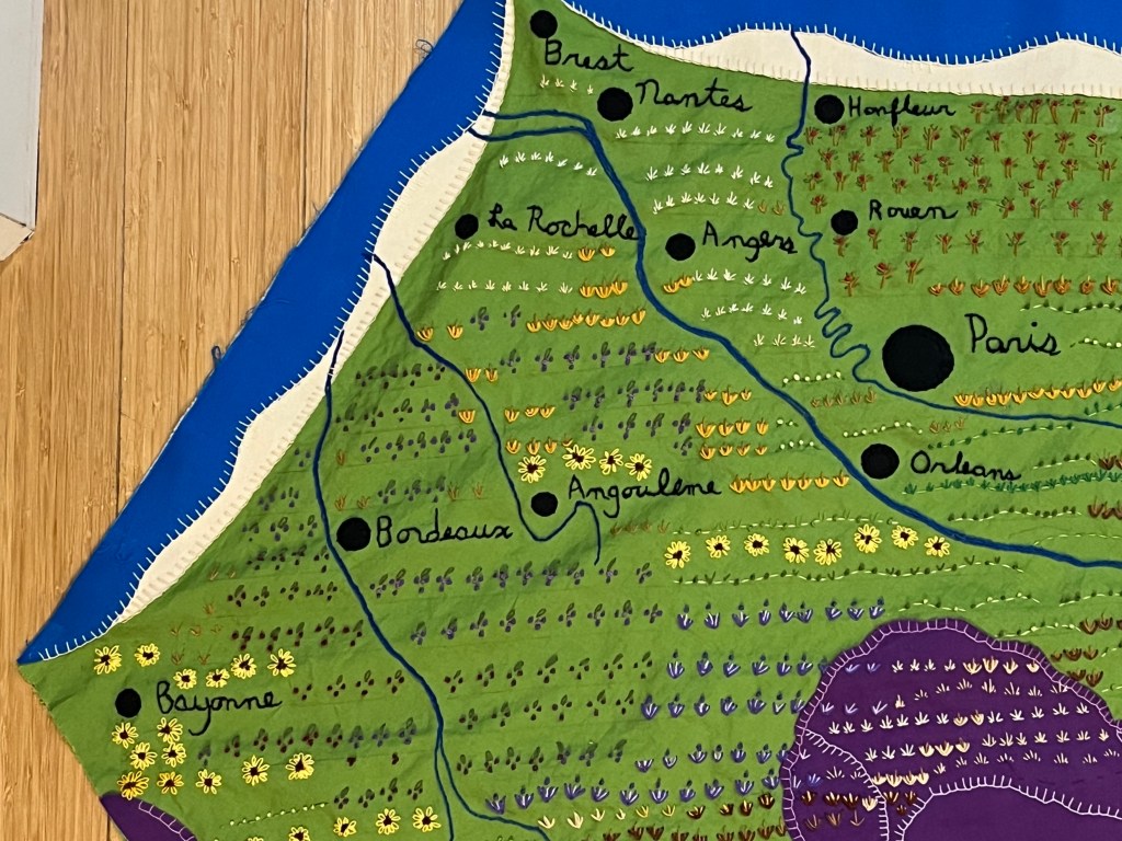
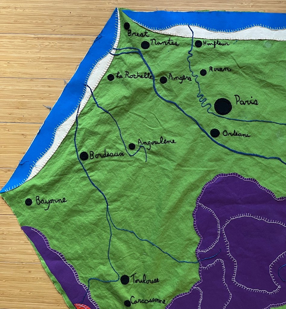
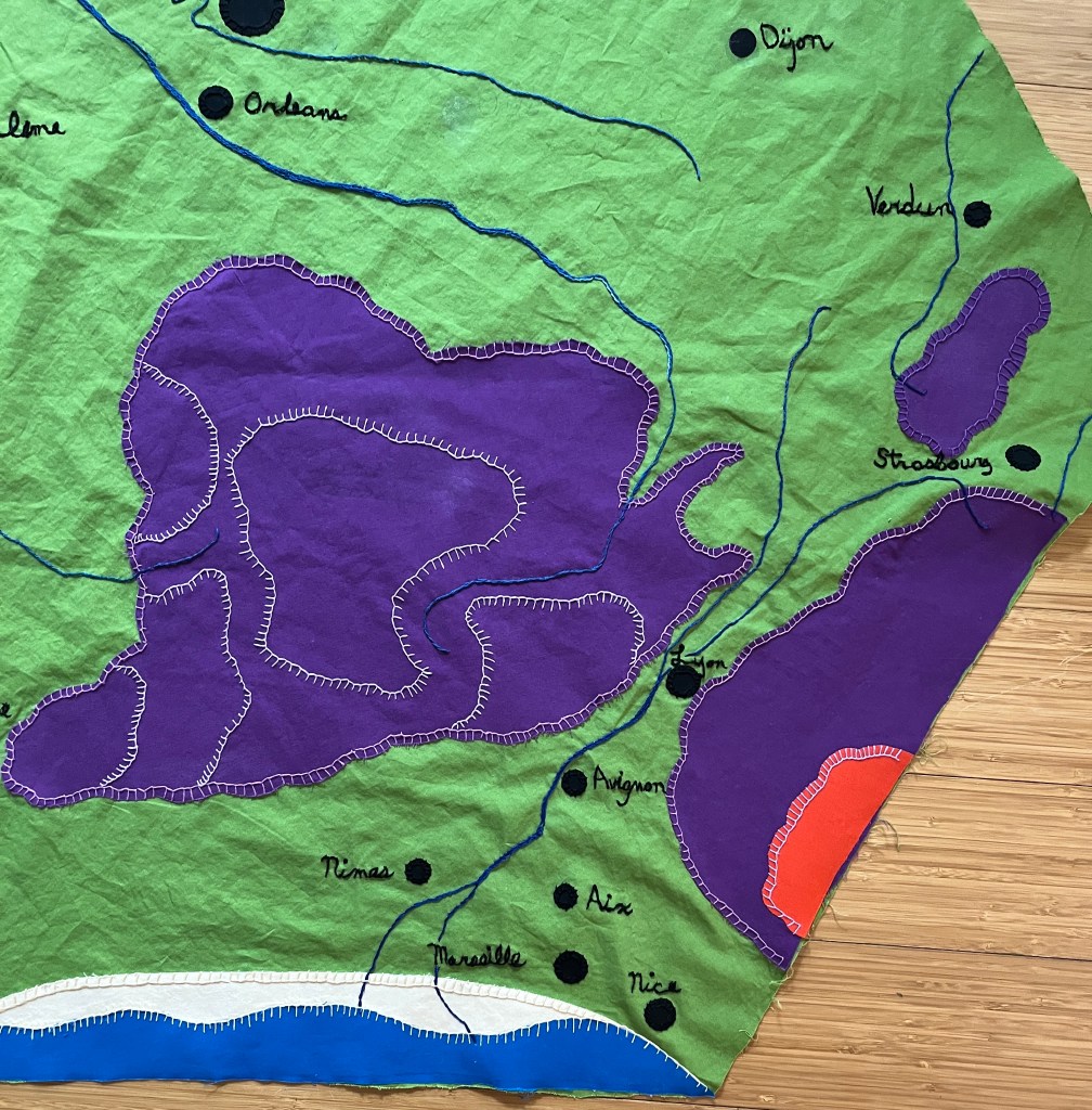
My problem is, I can’t look at the WHOLE thing at once, except when I take a picture of it. At about a meter across, it’s a lot to focus on. Below, I have broken it up into four photos.
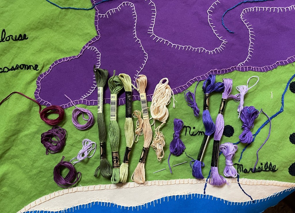
Looking here, I can see that I need more ‘grazing’ icons on the Massif Central and heading up into the Alps.
Here, the Pyrenees Mountains look a bit bare. And should there be something at the shore? Wavy lines to show the foam and dunes, maybe?
It’s hard for me to be objective… what do you think?
For now, I’m going to fold it up and let it sit. I’ll get back to it when I can see it fresh.
I have been working on my French map quilt steadily for a few weeks now, and I’m pretty happy with it so far.
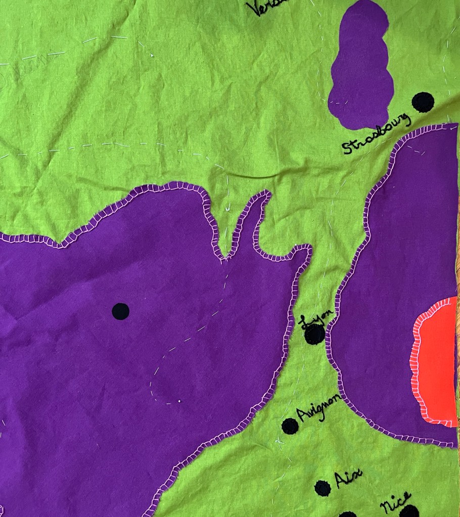
The rivers are embroidered, the city dots are ironed and sewn into place, the mountains and highlands edged, and the coastlines nice and swooshy.
Of course, it isn’t done yet. There is all that land between the main features that looks like it wants some detail.
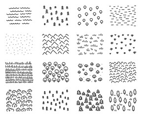
Rolling hills and grape vines, rocky crags and swampy spots, fields of wheat and rows of lavender, all need to add texture and interest.
So I will get started on the next step. I have chosen my color palette, looked at the symbols used in paper maps. I have come to terms with the fact that this will not, and cannot be, an accurate depiction. It will be, like all maps, an interpretation.
It was my intention to be very methodical about this quilt. First the land forms, then the cities, then the rivers, and so on. But that wasn’t working for me.
Embroidering the names of the cities is extremely fiddley, and hard to do for very long without getting a little crazy. There was lots of squinting and mumbling.
So I started alternating. A few cities, then some easy, sweeping lines on the mountains, then a few more cities. Then start on the Loire!
Then a walk in the park to stay balanced and happy.
Yes, I have made progress! Once I got the shorelines figured out, everything starting making sense.
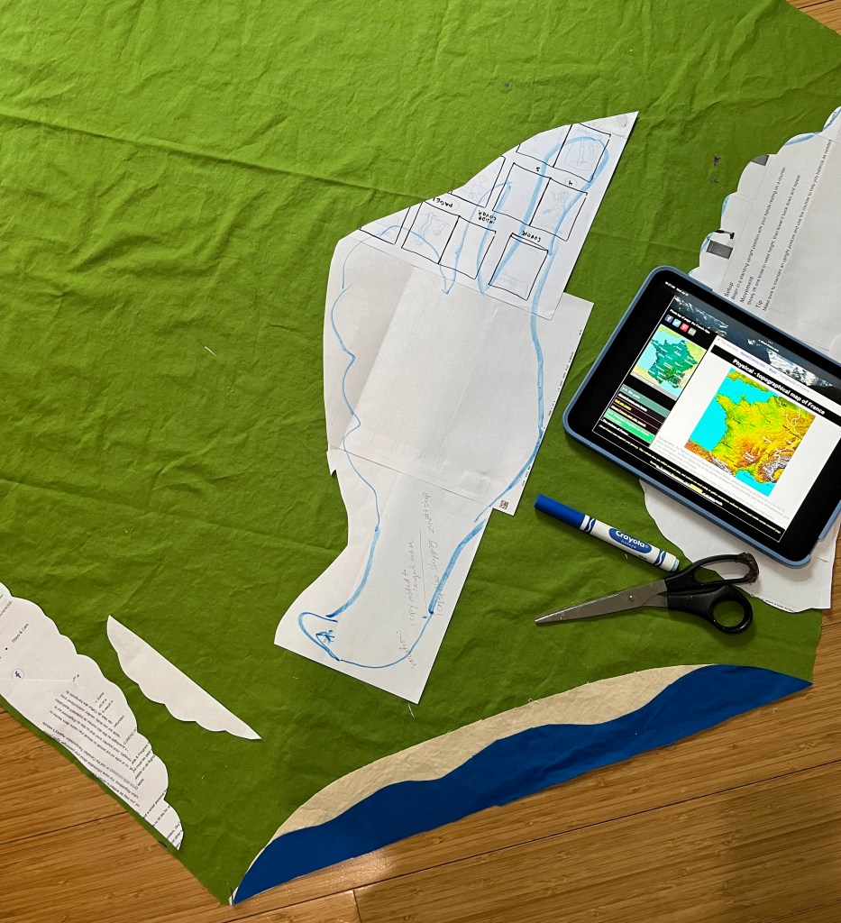
I kept looking at my patterns for the Grand Massif, the Alps, and the Pyrenees, and they were just …. Clunky. They made the whole eastern side of the country look like a mountain range, which just isn’t the case.
As you can see….
So I pulled up different topographical maps of France to see how I might make them better. Certainly more accurate, and maybe just a little prettier.
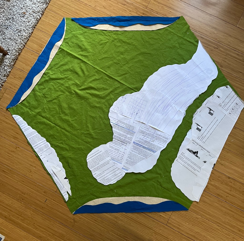
My process isn’t artistic, or even scientific. I glue sheets of scrap paper together and start cutting, staring and trimming until I get a shape I like.
This took a good part of the morning, because there is a lot of cutting, placing, staring, and walking away for a while. During the walking away parts I vacuumed, went shopping, and watched the Olympic Triathlon on YouTube.
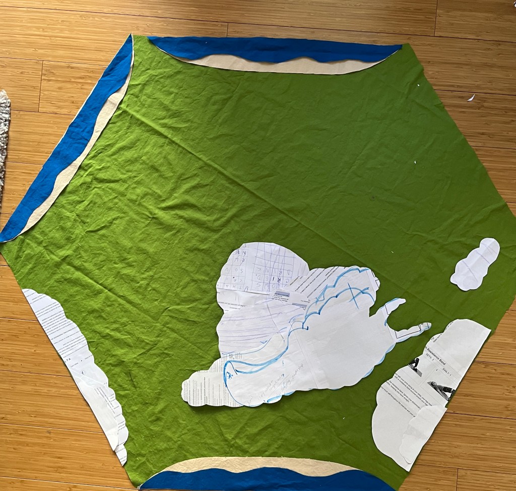
And when I got a pattern that was closer to the shape of the Massif, I laughed out loud. Un Escargot!!! That is, a snail.
I like that a lot. Escargot are one of the classic French dishes. Snails are also raised all over France for it, and it is one of Auntie Bridgett’s indulgences when we visit there.
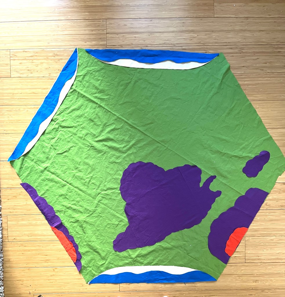
So I chuckled and pinned the patterns down, carefully trimming the lumpy shapes out of the purple fabric. The highest peaks of the Pyrenees and the Alps will be shown in red.
Et voilà! The big shapes are taken care of.
But there is one more detail hanging over my head.
I have this half yard of black fabric that I haven’t used yet. It is part of the color palette, and I think it will give the map some depth and drama. I intended it to be mountains, but it looked like a big black hole. I think it would be better as a detail, a curve or a line rather than a blob.
So now I get to stare at this for a while, and figure out what comes next.